
Hike description
Type
Signposted Loop
Altitude
Max : 901m
The audience
- For beginners / novice
Introduction
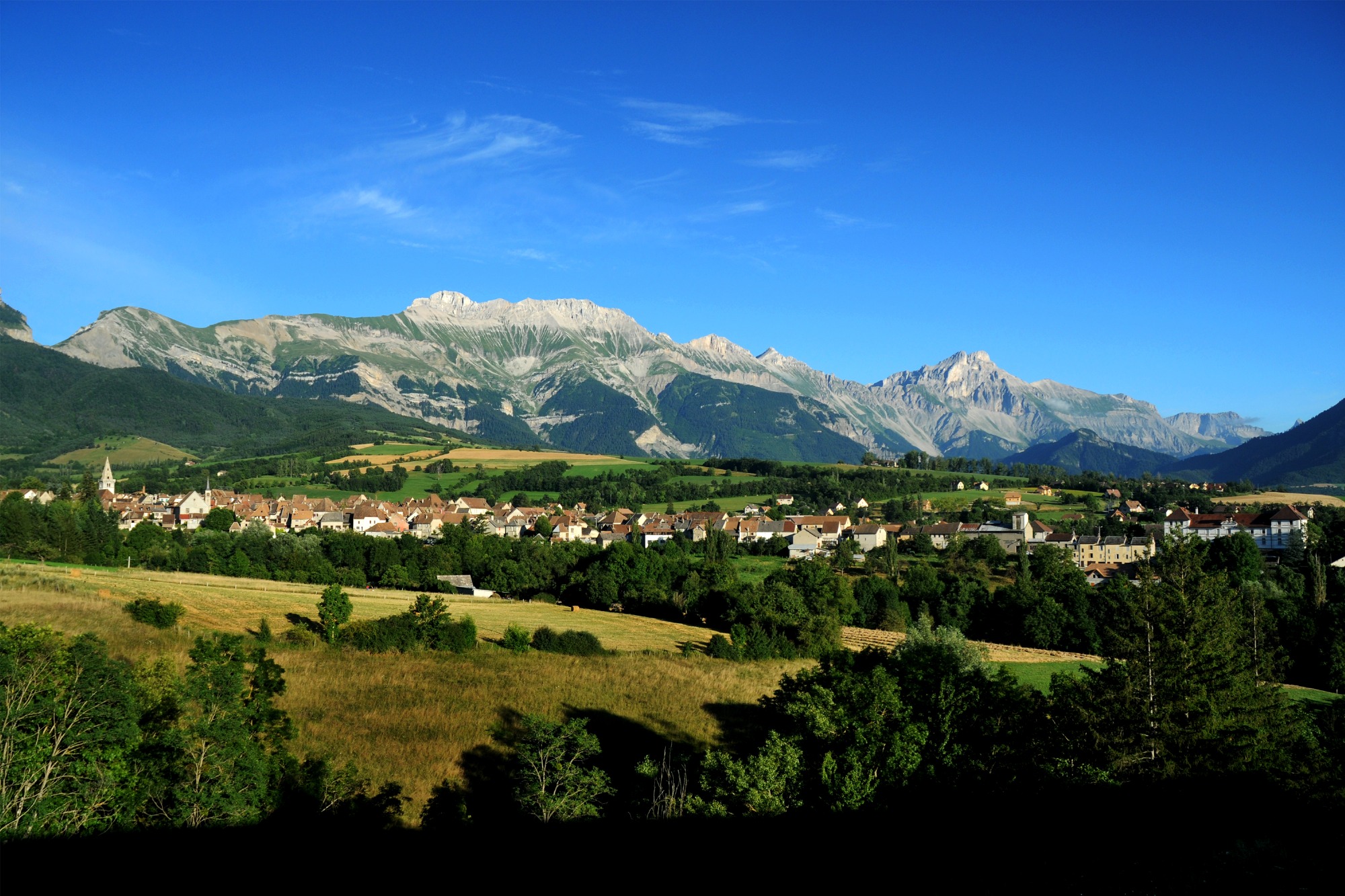
An ideal family outing that takes you to the heights of Mens. Through fields, forests and paths, you'll discover magnificent panoramas of the Dévoluy massif and the Vercors.
Set off on a family hike that will give you some of the best views of the village of Mens and its mountains. You'll follow a multitude of different paths through wheat fields, marshes and pine forests.
Give in to the temptation of this short stroll to admire the nature of the Trièves.
Pets welcome : yes
Further information on this Hiking Trail
The trail is marked with a yellow line (PR)
Map reference
Carte "Promenades et randonnées en Vercors Trièves"
Other information
Adaptez votre équipement en fonction de votre niveau et de la météo. Restez sur les sentiers balisés.
Useful information
Local Services
Access
Step by step
Departure : You start your walk from Place Paul Brachet in the center of Mens village (signposted "Mens Centre"). Continue to the end of the square and down the Chemin des Planches to the waste disposal center.
1 - From the "déchetterie" post, turn left towards Etang du Marais. Further on, leave the left-hand path and follow the direction of the pond. Follow the shaded stilt path alongside the stream. Leave the path and turn left onto the road. You'll then come to the pond, where you can stop to enjoy the soothing surroundings.
2 - From the "Etang du Marais" signpost, take the forest track towards Villette. A steep climb through the pine forest awaits you. At the end of the wood you'll find fields, so don't forget to turn right towards Villette. Follow the path through the fields (with a magnificent view of Dévoluy) to the D526, where you climb towards the hamlet of Villette.
3 - From the "Villette" signpost, climb up to the farmhouse and take the path just behind it. This long country lane offers views of the surrounding peaks. At the end of the path, turn right onto the road. Follow the main road down to the "Vénos" sign, where you can enjoy the scenery.
4 - From "Venos", take the right-hand path towards "La Croix des Planches", a long descent awaits you as far as the "La Croix des Planches" sign.
5 - From the "Croix des Planches" post, head towards the "Déchetterie" post, which is visible in front of you.
6 - From the "déchetterie" post, head for "Mens Centre" along the same path as before.
Location
36 Pl. Paul Brachet, 38710 Mens
38710 Mens
Hike departs from Mens village center, near the fountain next to the Auberge, signposted "Mens Centre". Bus line T95, Stop Place Robert Brachet (terminus)
Latitude : 44.816995
Longitude : 5.750594
Altitude : 760m
A découvrir aussi
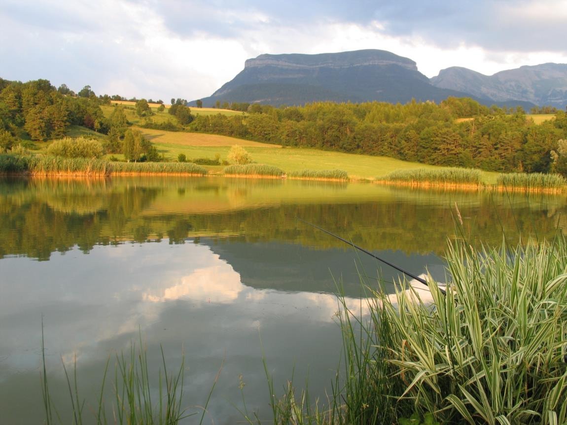
Pond located near the village of Mens, with a beautiful view of the Dévoluy range, including Obiou and Châtel. Handi-fishing site. Family walks and strollers: around the pond approx. 30 min.
Etang du marais
Mens
A short stroll to discover the village and take in the scenery around the "Historic Capital of the Trièves", including Obiou, Châtel and Mont-Aiguille.
Tour de Mens
Mens