
Hike description
Type
Signposted Loop
Altitude
Max : 1352m
The audience
- Walkers/hikers
Introduction
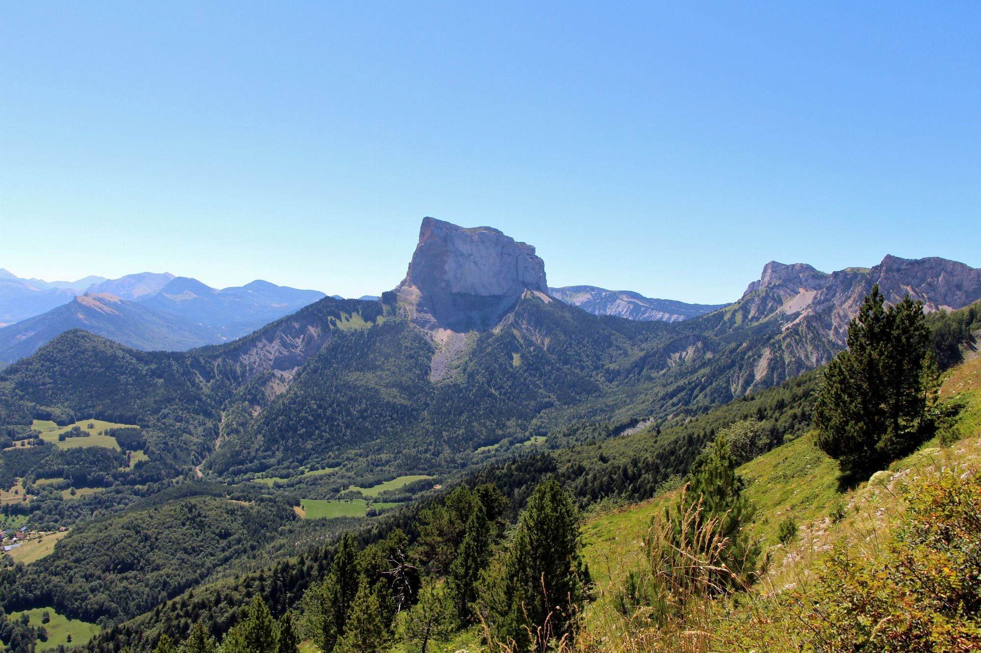
A pleasant walk from the village of Gresse en Vercors to the Col de l'Allimas and its magnificent view of Mont-Aiguille: ideal for a family picnic!
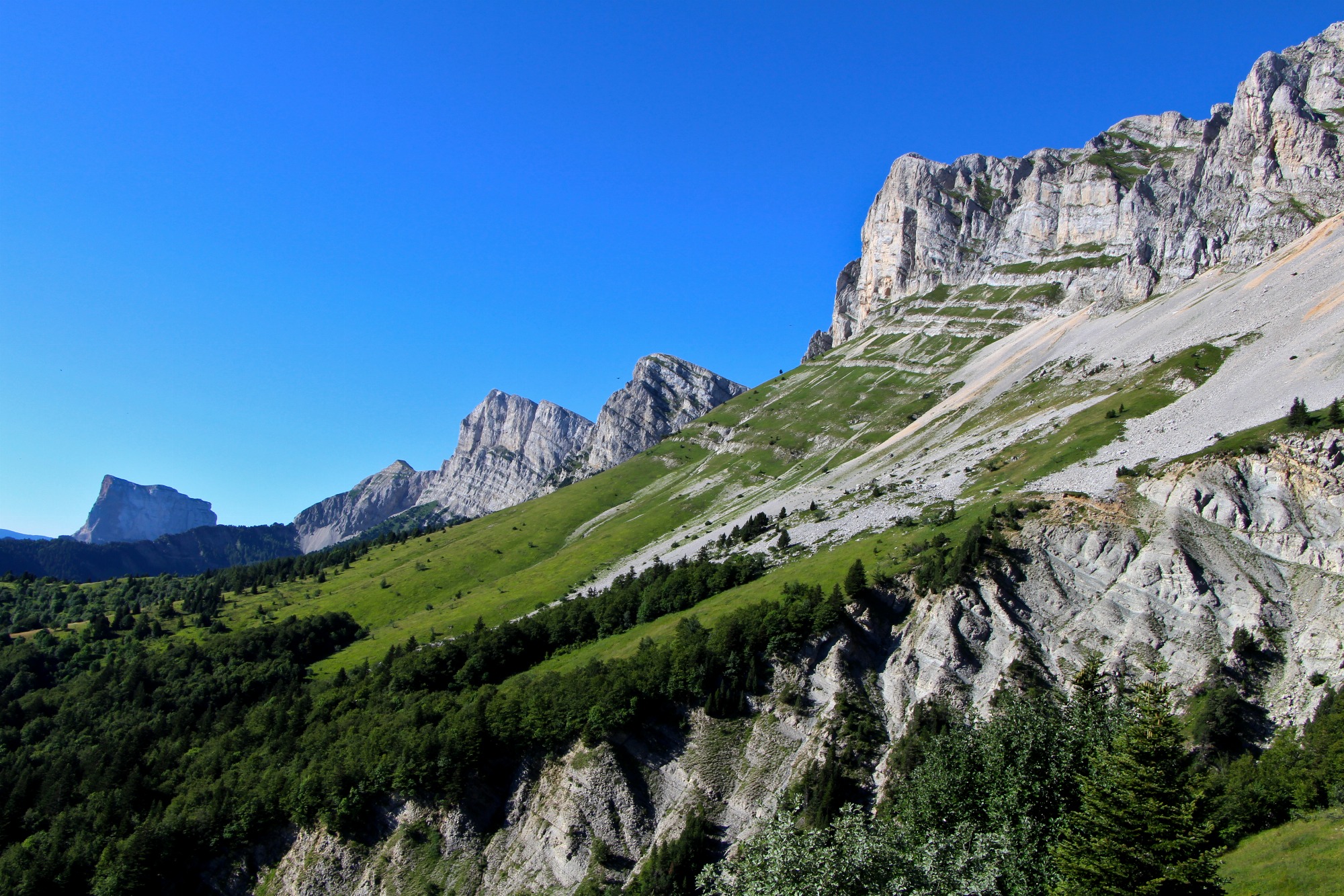
This hike offers views of Grand-Veymont, the cliffs of the Balcon Est du Vercors and Mont-Aiguille. In spring, exceptional flora accompanies your hike, including Lys-Martagon (a protected orchid). This hike alternates between open country and forest passages, for a variety of pleasures! You'll pass by the Odyssée Verte, a fun way to discover the world of the forest on tree-suspended footbridges.
Pets welcome : yes
Further detail on accompanying pets : Dog on leash.
Further information on this Hiking Trail
Marked with yellow lines (PR)
Map reference
Carte "Promenades et randonnées en Vercors Trièves"
Other information
Adaptez votre équipement en fonction de votre niveau et de la météo. Restez sur les sentiers balisés.
Useful information
Local Services
Facilities
Access
Step by step
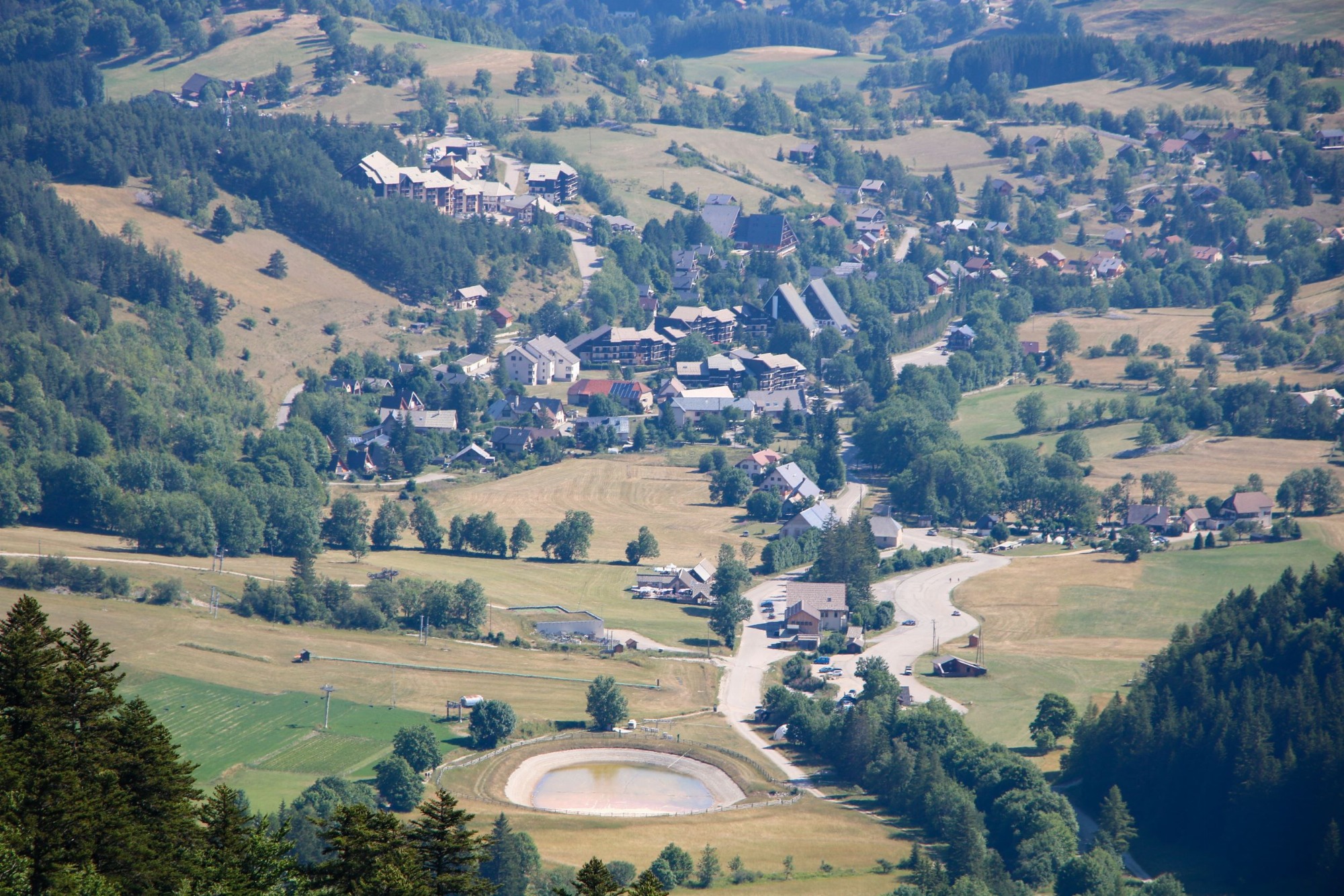
Departure: park near the church in the village of Gresse en Vercors, or in the parking lot at the entrance to the village, opposite the hotel-restaurant Le Chalet. Go to the municipal information point next to the church, where you will find the starting point.
1. Follow the signs for "Pas du Bru" up into the village, between the two restaurants "La Chicholière" and "Auberge Buissonnière". Continue straight ahead until you reach a crow's-foot, where you go straight ahead again to take a small path that rises gently and offers the first views of the mountains.
2. At the "Pas du Bru" post, follow the track to the right for a few dozen metres to reach the "Combe Rouge" post.
3. Then turn left towards "Col de l'Allimas", climbing steadily through the forest before joining a wider track. The track leads to the Col de l'Allimas, where you can admire Mont-Aiguille.
4. Return to the asphalt road for a few hundred metres before taking the right-hand track towards "Uclaire".
5. From "Uclaire", follow the signs for "Pas du Bru", going downhill to cross the Aulanier stream easily, then back up to the asphalt road. Cross the road to take the track to the "Pas du Bru" signpost.
6. At the "Pas du Bru" post, turn right to return to the starting point, following the same route in the opposite direction. You're back in the village, your starting point!
Location
Eglise de Gresse en Vercors
38650 Gresse-en-Vercors
Latitude : 44.902418
Longitude : 5.566818
Altitude : 1252m
A découvrir aussi
Start from the resort of Gresse-en-Vercors. This beautiful loop will allow you to discover the source of the famous stream that gave its name to the village, and to observe the Grand Veymont in all its forms.
Les sources de la Gresse
Gresse-en-Vercors
A hike that allows you to appreciate the majestic cliffs of the Balcon Est du Vercors! It's not unusual to come across wildlife, notably ibex and marmots. Beware: a few passages may put off hikers sensitive to vertigo.
Les balcons de Gresse
Gresse-en-Vercors
A varied walk alternating between forested and open stretches, the Brisou ridge offers magnificent views of Mont-Aiguille and Grand-Veymont. Two picnic tables make for a pleasant break at the summit!
La Crête du Brisou
Gresse-en-Vercors