
Hike description
Type
Signposted roundtrip
Altitude
Max : 1916m
The audience
- Walkers/hikers
Introduction
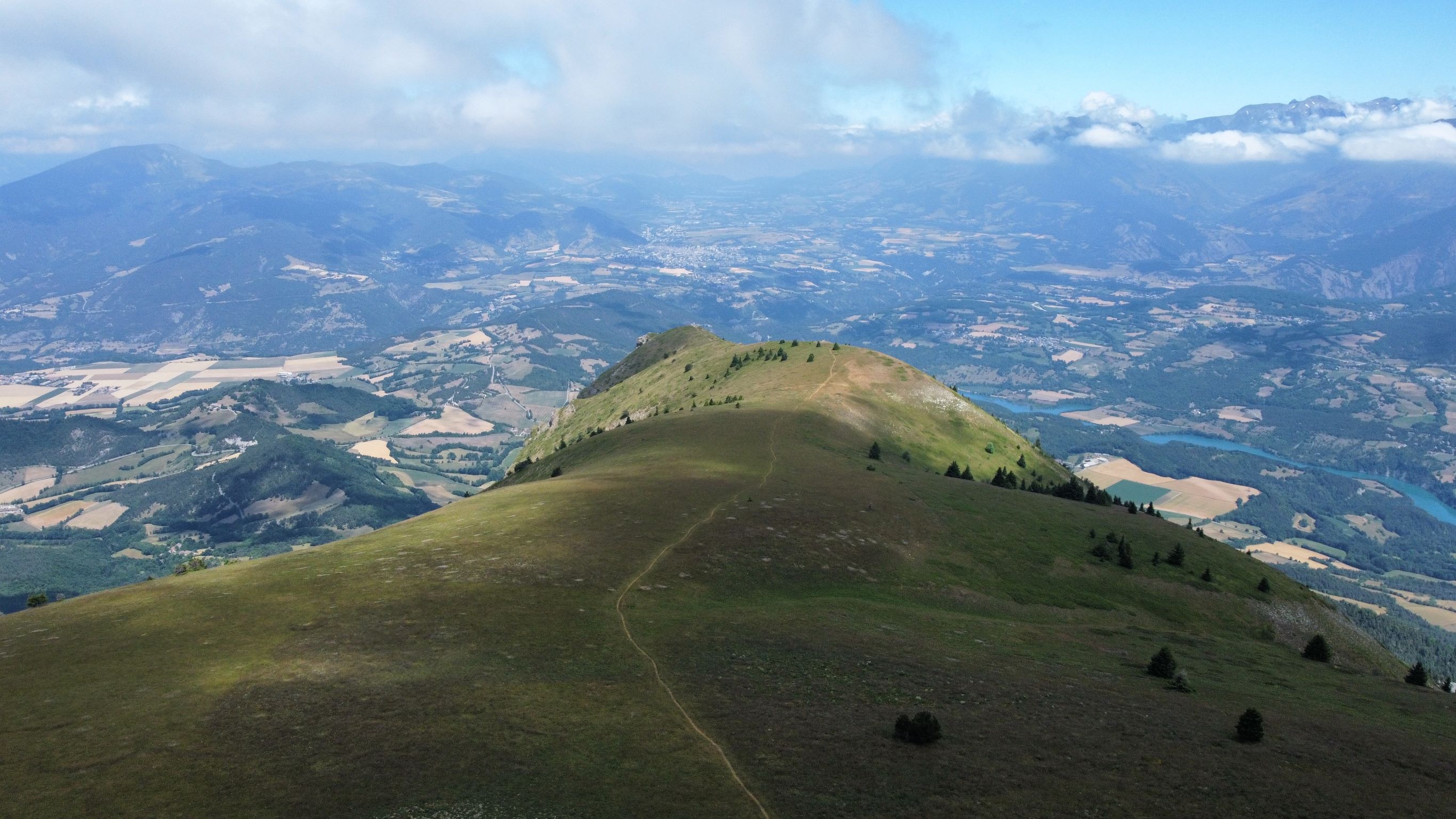
Take a magnificent trip to the top of the emblematic Châtel. One of the finest views of the colorful patchwork of Trièves farmland awaits you!
La Châtel, also known as Bonnet de Calvin, is a fairly difficult hike with some vertiginous passages. The cliffs near the summit are home to a wide variety of birds of prey. If you're lucky, you may come across vultures, eagles or falcons. This distinctive mountain can be seen from all over the Trièves. When you're at the top, you'll have a panoramic view of all the surrounding massifs. The perfect opportunity to take a day trip and have a picnic with a magnificent view. This out-and-back version avoids the cabled passage over the Col de la Brèche, which can be daunting for some hikers. Another topo allows you to do the complete loop.
Pets welcome : yes
Further detail on accompanying pets : Only on a leash! Caution, presence of guard dogs. Do not bring your dog during these periods.
Further information on this Hiking Trail
Yellow line markings (PR)
Tricky passes
Steep passages at the foot of cliffs can be vertiginous
Map reference
Carte "Promenades et randonnées en Vercors Trièves"
Other information
Adaptez votre équipement en fonction de votre niveau et de la météo. Restez sur les sentiers balisés. Merci de respecter les activités pastorales sur l'alpage (signalétique pastorale à l'entrée de l'alpage)
Useful information
Local Services
Facilities
Access
Step by step
Departure: From the "Parking de Baret", on the heights of Mens, accessible via a track above the hamlet of Le Verdier.
1) From "Baret", follow the path into the forest towards "Le Châtel". You will soon come to a signpost entitled "Les Granges de Châtel".
2) From "Les Granges de Châtel", follow the path up into the forest towards "Le Châtel". A pleasant climb through the forest will enable you to quickly gain altitude and begin to see the cliffs of Le Châtel.the path leads to a track which you take on the left to continue up to a clearing. After a short flat crossing, the climb becomes more difficult and the path passes beneath the cliffs. After crossing over to the right, the path rises again to finally reach the "Le Châtel" signpost.
3) From "Le Châtel" you have two options. You can go left to see the panoramic view from the orientation table. Alternatively, climb a little further to the top of Le Châtel, turning right at the signpost. This path will take you to a marker indicating the summit. From here, you can enjoy views of the Dévoluy Massif and, in particular, the Obiou. It's possible to make these two round trips.
4) From the "Châtel" post, start your descent towards the "Les Granges de Châtel" post. Take the same route as you did on the way up, but be careful!
5) Once you've reached the "Granges de Châtel" post, head for the Baret parking lot to reach your starting point.
Location
Parking de Baret
38710 Mens
By car, from the Mens Tourist Office, follow signs for Cordéac, Corps. At the "La Croix" crossroads, which indicates the gendarmerie on the right and the D 66 on the left, go straight on towards "Le Verdier". Pass "Pré Clos", "Mentayre", then "Le Verdier" until the tarmac road becomes a track. Follow the forest track for 3.5 km to the "Baret" parking lot.
Latitude : 44.82229
Longitude : 5.790699
Altitude : 1282m
A découvrir aussi
La table d'orientation du Châtel vous offre un panorama exceptionnel sur les massifs environnants tel que les Écrins, le Dévoluy ainsi que le Trièves.
Table d'orientation du Châtel
Mens
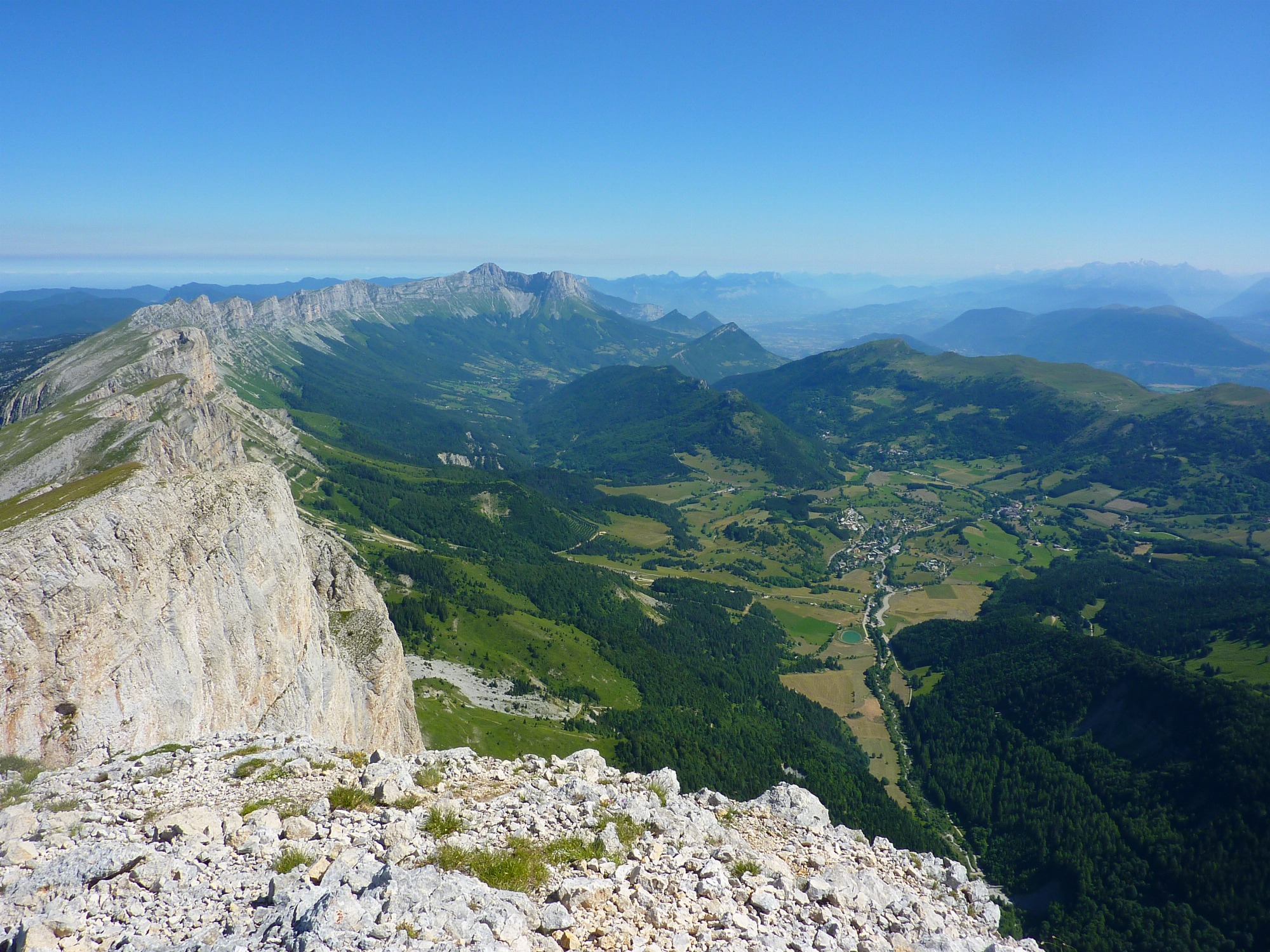
The highest point in the Vercors massif at 2341m, Grand-Veymont offers magnificent 360° views! It overlooks the village of Gresse en Vercors, Mont-Aiguille and the impressive cliffs of the Balcon Est du Vercors.
Grand-Veymont via Pas de la Ville
Gresse-en-Vercors