
Hike description
Type
Signposted Loop
Altitude
Max : 1710m
The audience
- For experts / practiced
- Walkers/hikers
Introduction
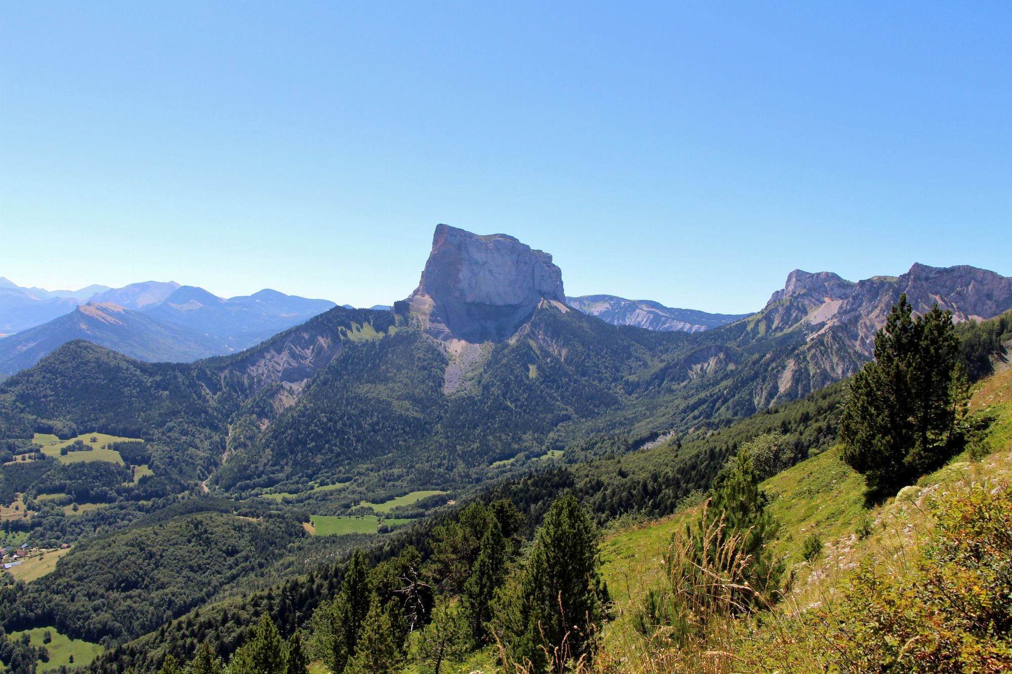
This superb, long hike allows capable ramblers to view the limestone needle, separated from its original neighbouring cliff, from all angles. You will encounter an astonishing variety of landscapes.
From the car park, retrace your steps for 300m and take the path to the left, which leads to the edge of the forest, and then continues uphill alongside it. Then walk alongside cultivated fields to join another path, and turn left. The track rises at first before descending to join up with the road to Trézanne. After the Romanesque chapel, walk up to the Col de Papavet. From the pass, continue to the left along a wooded ridge until you reach the Col des Pellas. Descend into the hamlet of Les Pellas (typical houses of the Trièves region). Follow the road to the left for 500m, then, on the bend, continue straight ahead, towards the Col de l'Aupet. You will pass paths off to the right which lead to Pas des Bachasson and Pas de la Selle. A forest track, which starts off steep, will take you to a point above the La Pisse waterfalls. The many fallen trees beneath Mont Aiguille are testament to the harshness of this steep slope. The track continues on a gentle downhill slope to reach the Col de l'Aupet. Take the path on the steep, south-west side of Mont Aiguille to descend. The path emerges among the meadows of the Côtes de la Doux before reaching the bottom of the valley. Turn left to head back to the car park.
Pets welcome : no
Further detail on accompanying pets : Dogs are not allowed on this hike (passes through the Vercors High Plateaus Natural Reserve)
Further information on this Hiking Trail
Yellow-and-green (Vercors Natural Park)
Tricky passes
This long hike requires a good level of physical fitness. In spring, enquire about the presence of névé in the steep, craggy sections.
Map reference
Carte IGN 3236 OT
Hiking Topo Guides
Cartoguide "Promenades et randonnées en Vercors-Trièves"
Other information
Bring clothing and equipment appropriate for your ability level and the weather conditions. Do not leave the marked paths.
Useful information
Local Services
Facilities
Access
Step by step
Start :Park in the parking lot near the Nordic hostel in the Richardière hamlet, where you'll find the "Richardière" sign.
1) Head towards "Pont de Donnière", passing behind the hotel-restaurant "Au Gai Solei du Mont-Aiguille".
2) At "Pont de Donnière", turn left along the camp towards "Aux Fontaines". The path soon becomes a track that passes the foot of Mont-Aiguille.
3) At "Aux Fontaines", take the left-hand track towards "Les Ruines", which rises and becomes a path to a pretty viewpoint. Descend to reach the "Les Ruines" signpost.
4) Turn left on the asphalt road to reach the charming hamlet of "Trézanne" and continue to "Seiterat".
5) Climb up to Col de Papavet via "Les Brutinels" and "Les Sagnes".
6) After enjoying the view, turn left along the ridge towards "Col des Pellas". You will then come across the cabane des charbonniers and continue on to the Col des Pellas.
7) Take the left-hand path downhill, which soon takes you to the "Les Grands Clots" signpost, and continue downhill on the path to "Caraby" and "Les Pellas".
8) At "Les Pellas", turn left up the asphalt road and continue left to "Chez Cotte".
9) Keep left on the road, then go straight on towards the adventure trail to reach the "Les Granges" sign.
10) Take the left-hand track, which climbs gradually to "Sous la cascade de la Pisse", then becomes a steeper path to the Col de l'Aupet, the starting point for climbers on their way to the summit.
11) Descend through the forest towards La Richardière, before joining a track that takes you back to your starting point.
Location
La Richardière
38930 Chichilianne
Gai Soleil car park at La Richardière. From Grenoble, take the A51 until you reach the Col du Fau, then take the D1075 and continue for 14km. Before Clelles, turn right towards Chichilianne, then after another 2.3km, turn right towards Richardière.
Latitude : 44.822493
Longitude : 5.547526
Altitude : 1057m
A découvrir aussi
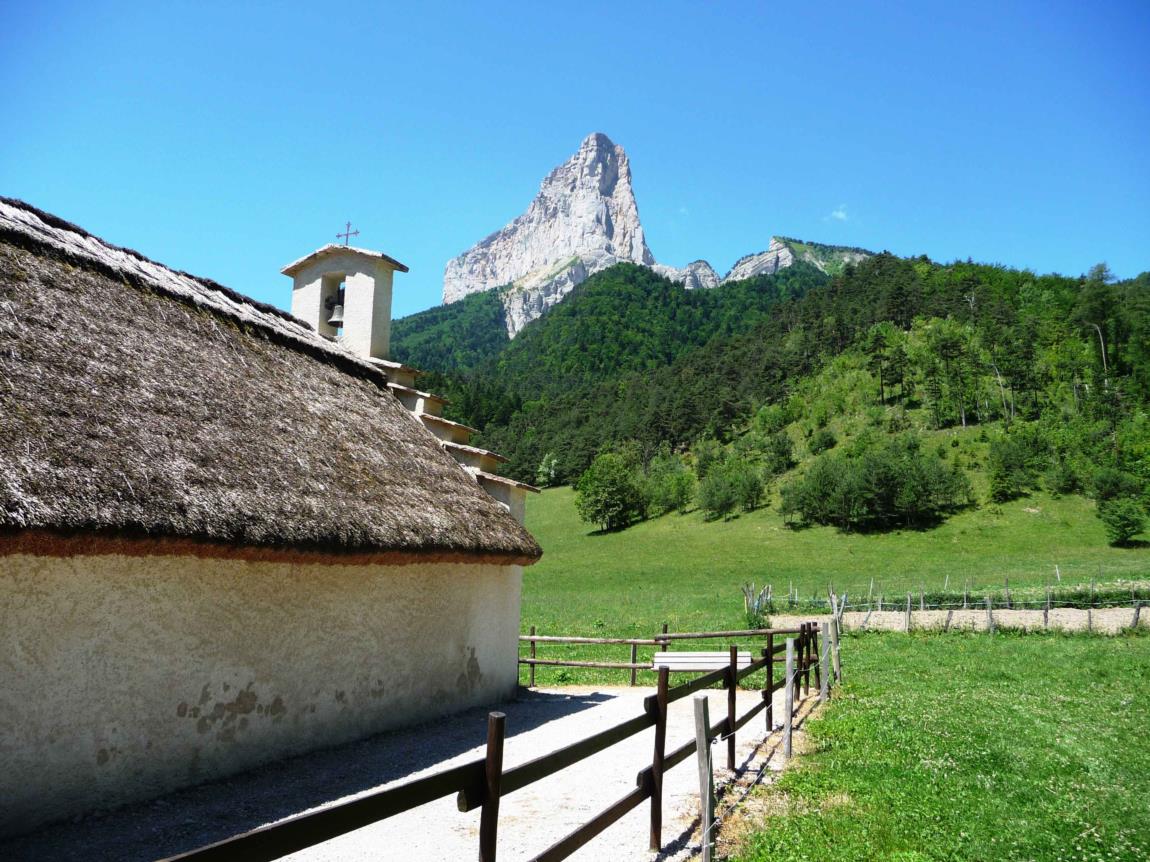
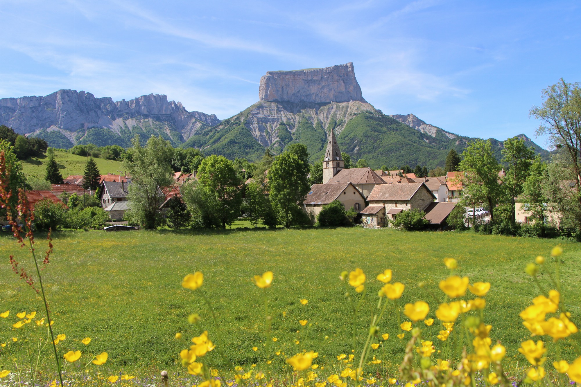
La petite Chapelle de Trézanne fait face au majestueux Mont-Aiguille.
Nichée à son pied, elle offre une des plus belles vues sur ce sommet de 2087 m d'altitude.
Chapelle de Trézanne
Saint-Martin-de-Clelles
A varied walk alternating between forested and open stretches, the Brisou ridge offers magnificent views of Mont-Aiguille and Grand-Veymont. Two picnic tables make for a pleasant break at the summit!
La Crête du Brisou
Gresse-en-Vercors
A pleasant walk to discover the village of Chichilianne nestled at the foot of Mont-Aiguille, ideal for a family outing!
Chichilianne Tower
Chichilianne